
Dickinson Neighbors by Public Source
Public records can describe a Dickinson block in pieces. The county ArcGIS viewer supplies parcel geometry and aerial context. GCAD supplies a tax account and recorded owner for a selected parcel. The county deed index can explain a transfer, plat, easement, or legal description. None of those records is a public list of all occupants. Election tools are individual lookup tools, and local groups may offer a public contact but not a member roster. Treat the record owner, the map parcel, and a historical subscriber as different kinds of facts.
| Source | What it shows about a block | Access |
|---|---|---|
| County ArcGIS viewer | Parcel geometry, nearby parcels, aerial context, and available layers | Free public map; informational |
| GCAD search | Owner of record, tax account, situs, mailing field, parcel IDs, and legal description | Free; query parcels individually |
| County deed index | Transfers, plats, restrictions, easements, and legal chain | Free index; copies may cost |
| Texas voter lookup | One person's status and polling information | Name, county, date of birth, ZIP, VUID, or eligible ID route |
| City permit or code file | Address-related work, inspection, or complaint sequence where releasable | MyGov account or Texas Public Information Act request |
| Historical sources | Older address or subscriber snapshots from directories and archives | Library, archive, or in-library database access |
The important boundary is owner versus occupant. A current owner may receive tax mail somewhere else. A historic directory may describe a subscriber at a past date. A public parcel search cannot supply a complete list of people at an address, including people whose records are protected or never placed in a public index.
Map Dickinson Neighbors From Parcels
Use the Galveston County Interactive County Map as a visual starting point. Enter the address in Find address or place, zoom until parcel lines are visible, and open the target parcel's popup. Turn on the parcel layer, then click each bordering parcel and note the parcel or geographic ID and legal description. The map's aerial toggle can clarify a shared drive, drainage line, bayou, street, or visible lot edge. It cannot turn aerial context into a legal boundary decision.
The practical flow is address → target parcel popup → bordering parcel IDs and legal descriptions → a separate GCAD search for each parcel. A radius or buffer tool was not verified in the available county viewer research, so do not treat an assumed radius as an official neighborhood boundary. Where the map and deed language differ, the recorded plat and legal description control. Flood and map layers are useful context, not a boundary survey.
Note: Save the map date and parcel ID with each result because county layers, aerial imagery, and tax accounts can change independently.
Check Dickinson Neighbor Parcel Records
After selecting a parcel, use Galveston CAD to read that parcel's owner-of-record and tax fields. Search by address, ID, or an available advanced field, then copy the situs address, mailing address, property ID, geographic ID, subdivision, and legal description. A situs is the parcel's physical location. A legal description identifies the land through a lot, block, subdivision, survey, or abstract. The mailing field is only tax correspondence. It is not evidence that the addressee lives on the block.
For a change in ownership or a boundary question, query the Galveston County Clerk real-property records with the owner name and legal description. Deeds, plats, and restrictions can show how a parcel was described at recording. Search both directions in a transfer chain: the current owner as grantee for an acquisition, then an earlier grantor or prior grantee as the trail moves back. Record the instrument number or book and page so the clerk can locate the same document.
GCAD's owner, mailing, and situs fields are a useful comparison, not an all-resident roll. A Dickinson mailing address can also reach beyond the city limit, including places identified with League City or Texas City. Parcel and recorded-description details provide the clearer jurisdiction trail.
Use Dickinson Neighbor Voter Rules
My Voter Portal does not offer a public block query for Dickinson neighbors. It looks up one voter through a name, Galveston County, date of birth, and ZIP combination, or through a VUID or qualifying Texas driver-license or personal-ID route. The result can report status, VUID, precinct, county, and polling-place information. It does not establish that other people at the same address are registered, and it never reveals a ballot choice.
Texas Election Code §§13.004, 18.005, and 18.066 limit sensitive voter information. Qualifying residence addresses are suppressed, and the statewide voter-file request process requires a written request and affidavit. Texas voters can suppress web display in the manner state guidance allows. The 2026 state election advisory also explains confidential handling for Address Confidentiality Program participants. When a resident's address is protected, do not attempt to reconstruct it from parcel, map, or neighbor records.
| Official route | What it answers | What it does not answer |
|---|---|---|
| Individual voter lookup | One person's registration and polling route | Everyone on a block |
| GCAD parcel record | Recorded owner and parcel facts | All occupants |
| Recorded deed or plat | Title or legal-description history | Present-day social connections |
Find Dickinson Neighbor Civic Contacts
Dickinson's boards and commissions page lists public civic bodies, including the Animal Advisory Committee, Board of Adjustment, Building Standards Committee, Dickinson Education Finance Corporation, Dickinson Management District, Economic Development Corporation, and Planning and Zoning Commission. These are public participation bodies, not neighborhood member lists. The city planning material refers to private associations and neighborhood groups, but research did not locate a verified public directory of private associations, members, or block-watch rosters.
| Public community route | Useful purpose | Roster boundary |
|---|---|---|
| City boards and commissions | Meeting, application, agenda, and civic-participation information | Not a resident directory |
| Dickinson Management District No. 1 | Public special-district context under Texas law | Not a private association roster |
| Dickinson Historical Society | Historic articles, photographs, cemetery study, and community material | Archive, not a current membership list |
| Faith United/Warren Chapel, Queen of Angels/True Cross, First Baptist, and Holy Trinity | Potential historical congregation or memorial context | Current lists should be treated as private |
The Dickinson Historical Society is the strongest public archive for older community context. It has a 1937 phone book, cemetery material, local articles, and a 1991 aerial item. Ask an institution for historical material it chooses to share. Do not represent a private congregation or association list as a public neighborhood record.
Note: Public meeting contacts support civic questions, while private membership lists remain with the organizations that maintain them.
Request Dickinson Neighbor Address Files
Address-keyed city files can place work or a complaint in time. Dickinson's MyGov process covers permits, review comments, approved permits, inspection scheduling, inspection results, and payments through registered accounts. Public unauthenticated browsing of all permits by address was not confirmed. When an online view does not expose the needed record, make a precise request through the city Public Information Act form with the exact address and date range. Code Enforcement complaint records can include report number, address, status, inspection, and releasable owner or occupant references.
The Dickinson code-enforcement complaint process shows the address-based workflow.
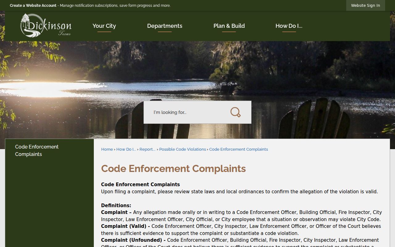
The workflow is useful for the record path, while individual complaint details and protected information may be withheld or redacted.
A clear request names the property, the records sought, the relevant date range, and preferred delivery format. Texas Public Information Act requests can require clarification or charges when they are broad. The public route is the custodian's record process, not an attempt to compile a private list of the people around an address.
Trace Dickinson Neighbors Around a Block
Keep the immediate block method narrow. The map identifies nearby parcels; GCAD identifies an owner of record for each selected parcel; deed and plat records test the legal description; then an address-dated permit, archive, or directory can add a time period. That process avoids treating a current tax account as a full picture of a block. The 1920 rural directory, 1937 phone book, 1959 telephone directories, and Clear Lake Area runs provide historical snapshots, not a current neighbor list.
- Enter one address in the county GIS viewer and open its parcel popup.
- Click only the parcels that visually border it, then record each displayed ID and legal description.
- Run each ID or address separately in GCAD and distinguish mailing address from situs.
- Use deeds or plats where a recorded boundary or ownership change matters.
- Use a dated city file or historical directory only to answer that period's question.
For a full named-street chain rather than the parcels immediately around one address, the Dickinson street directory uses the broader address-by-address record path.
Protect Dickinson Neighbor Privacy
Public parcel data identifies land and recorded owners. It does not identify every private occupant, utility customer, delivery recipient, unlisted subscriber, DMV-address holder, protected voter, or private association member. Texas's Address Confidentiality Program provides an eligible participant with a substitute mailing address and has its own application rules. The Texas Data Privacy and Security Act, Tex. Bus. & Com. Code §541.001 et seq., creates defined consumer rights for covered controllers, but it does not erase county records held under another law.
Official parcel, deed, and public civic records are more transparent about their source and limits than commercial neighbor tools. A commercial category may combine public filings with purchased data, merge similar names, and preserve stale entries. Verify any fact with the custodian instead. Galveston County's free Property Fraud Alert monitors a submitted name when it appears on a recorded county document. It is an alert service, not title insurance or a legal title review.
Lawful use. Dickinson neighbor records support personal, lawful research and civic awareness. Texas stalking and harassment laws prohibit using public information to monitor, threaten, or harm another person.